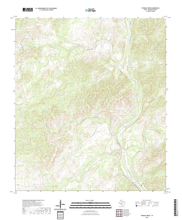
2022 Map of Twomile Draw
USGS Topo · Published 2022About this map
The West Nueces River carves a significant course through this Edwards County landscape, where the hydrography is defined by a network of seasonal drainages including Twomile Draw, Threemile Draw, and Fivemile Draw. This ranching country in the early 21st century is traversed primarily by Ranch Rd 674 and local tracks like Stone Crk Ranch Rd, reflecting the modern subdivision of traditional Texas hill country land. A key point of historical interest is the Thurman Cem, a small burial ground situated near the southern confluence of Kickapoo Cr and the river. The presence of Kickapoo Spring indicates a vital water source in an otherwise arid environment where named creeks like Indian Cr and Flat Cr form deep, winding impressions across the terrain.
Find a feature on this map
13 named features on this map. Tap any name to fly to it.
Don’t see what you’re looking for? This feature index may not catch every label — zoom into the map to look around manually.
Map Details
Editions of this 2022 Twomile Draw Map
This is the sole edition of this map. No revisions or reprints were ever made.
Other maps of this area

1893 · Nueces
USGS Topo · 1:125,000

1896 · Nueces
USGS Topo · 1:125,000

1943 · Carta Valley
USGS Topo · 1:62,500

1944 · Flat Rock
USGS Topo · 1:62,500

1944 · Indian Creek
USGS Topo · 1:62,500

1944 · Indian Mountain
USGS Topo · 1:62,500

1958 · Del Rio
USGS Topo · 1:250,000

1964 · Del Rio
USGS Topo · 1:250,000
1967 · Indian Mountain
USGS Topo · 1:24,000
1971 · Carta Valley NE
USGS Topo · 1:24,000