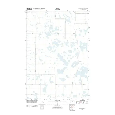
2012 Map of Twomile Lake
USGS Topo · Published 2012About this map
Twomile Lake and a dense cluster of prairie glacial lakes dominate this landscape in Marshall County, South Dakota. This region is characterized by an intricate network of wetlands and seasonal water bodies, including Threemile Lake, Fourmile Lake, and Elm Lake. The cartography reveals a highly structured section-line road system, where routes like 430th Ave and 115th St navigate around the irregular shorelines of Goose Lake and Mallard Slough. To the south, Alberts Lake sits near the junction of Rose Hill Rd, illustrating how early land surveys and local travel were dictated by these water-rich depressions. The presence of features such as Clubhouse Slough and Horseshoe Lake underscores the area's significance for local hydrology and habitat conservation within the larger Great Plains drainage patterns.
Find a feature on this map
24 named features on this map. Tap any name to fly to it.
Don’t see what you’re looking for? This feature index may not catch every label — zoom into the map to look around manually.
Map Details
Editions of this 2012 Twomile Lake Map
This is the sole edition of this map. No revisions or reprints were ever made.
Other maps of this area

1953 · Britton East
USGS Topo · 1:24,000

1953 · Milbank
USGS Topo · 1:250,000

1954 · Kidder SE
USGS Topo · 1:24,000

1958 · Milbank
USGS Topo · 1:250,000

1958 · Britton 4 NW
USGS Topo · 1:24,000

1958 · Hillhead
USGS Topo · 1:24,000

1958 · Britton 4 SW
USGS Topo · 1:24,000

1970 · Eden
USGS Topo · 1:24,000

1970 · Britton 4 NE
USGS Topo · 1:24,000

1970 · Lake City
USGS Topo · 1:24,000