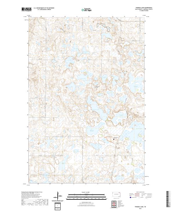
2021 Map of Twomile Lake
USGS Topo · Published 2021About this map
Coteau des Prairies defines the rolling, water-dotted landscape of this Marshall County survey, characterized by a dense network of glacial lakes and wetlands. The most significant historical landmark is the Fort Sisseton Post Cem, located along the Fort Sisseton Trl, which points to the 19th-century military presence in the region. The geography is dominated by numerous named water bodies, including Twomile Lake, Threemile Lake, and Horseshoe Lake, which are separated by low rises and drainage features like Oak Gulch. This modern survey illustrates how early transport routes and military landmarks have been integrated into a grid of county roads and agricultural boundaries, maintaining a sense of the area's frontier history through names like Parsons Pass.
Find a feature on this map
35 named features on this map. Tap any name to fly to it.
Don’t see what you’re looking for? This feature index may not catch every label — zoom into the map to look around manually.
Map Details
Editions of this 2021 Twomile Lake Map
This is the sole edition of this map. No revisions or reprints were ever made.
Other maps of this area

1953 · Britton East
USGS Topo · 1:24,000

1953 · Milbank
USGS Topo · 1:250,000

1954 · Kidder SE
USGS Topo · 1:24,000

1958 · Milbank
USGS Topo · 1:250,000

1958 · Britton 4 NW
USGS Topo · 1:24,000

1958 · Hillhead
USGS Topo · 1:24,000

1958 · Britton 4 SW
USGS Topo · 1:24,000

1970 · Eden
USGS Topo · 1:24,000

1970 · Britton 4 NE
USGS Topo · 1:24,000

1970 · Lake City
USGS Topo · 1:24,000