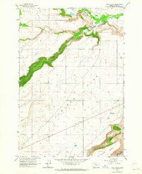
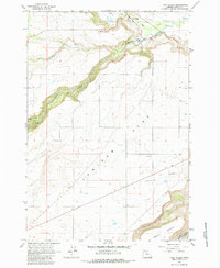
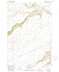
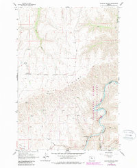
1962 Map of Tygh Valley
USGS Topo · Published 1964About this map
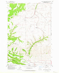
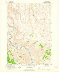
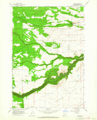
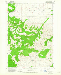
White River carves a deep, winding canyon through the central landscape of this quadrangle, creating a stark contrast between the steep riparian slopes and the broad upland plains of Juniper Flat to the south. In the early 1960s, the small community of Tygh Valley served as a focal point for the region, positioned near the confluence of Tygh Creek and the river. The map illustrates a rural economy transitioning through the mid-20th century, with scattered infrastructure including a Grange Hall and an Airstrip located on the flat plateau. These features, along with a local Cem, provide valuable coordinates for family historians and genealogists tracing the settlement patterns of Wasco County. Irrigation and water management are evident through labels for various Springs and named drainages like Threemile Creek and Wapinitia Creek, which supported the livestock and agricultural operations designated here as Natural Pasture.
Find a feature on this map
15 named features on this map. Tap any name to fly to it.
Don’t see what you’re looking for? This feature index may not catch every label — zoom into the map to look around manually.
Map Details
Editions of this 1962 Tygh Valley Map
3 editions found
Other maps of this area

1930 · Dufur
USGS Topo · 1:125,000

1934 · Dufur
USGS Topo · 1:125,000

1953 · The Dalles
USGS Topo · 1:250,000

1956 · The Dalles
USGS Topo · 1:250,000

1957 · The Dalles
USGS Topo · 1:250,000
1962 · Sherars Bridge
USGS Topo · 1:24,000
1962 · Postage Stamp Butte
USGS Topo · 1:24,000
1962 · Dant
USGS Topo · 1:24,000
1962 · Wamic
USGS Topo · 1:24,000
1962 · Wapinitia
USGS Topo · 1:24,000