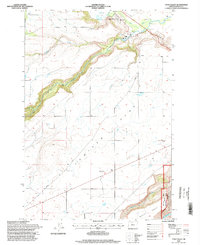
1996 Map of Tygh Valley
USGS Topo · Published 1998About this map
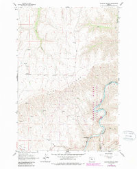
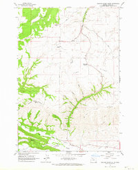
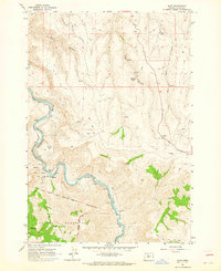
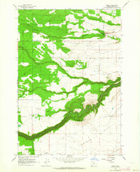
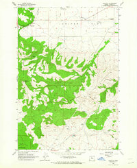
Tygh Valley serves as the focal point of this mid-1990s landscape, where the confluence of several watercourses defines the local topography. The White River carves a deep canyon across the northern half of the sheet, eventually joining the Deschutes River at the eastern margin. The transition from the alluvial valley floor to the broad, elevated bench of Juniper Flat reveals the area's agricultural reliance on creek drainage systems like Tygh Creek and Wapinitia Creek. Local infrastructure and land use are evidenced by the presence of a Landing Strip and a Cemetery, alongside significant conservation areas such as the Deschutes National Recreation Lands. This survey reflects a moment when traditional land use on the Natural Pasture met increasing federal oversight within the Deschutes Wild and Scenic River corridor.
Find a feature on this map
18 named features on this map. Tap any name to fly to it.
Don’t see what you’re looking for? This feature index may not catch every label — zoom into the map to look around manually.
Map Details
Editions of this 1996 Tygh Valley Map
This is the sole edition of this map. No revisions or reprints were ever made.
Other maps of this area

1930 · Dufur
USGS Topo · 1:125,000

1934 · Dufur
USGS Topo · 1:125,000

1953 · The Dalles
USGS Topo · 1:250,000

1956 · The Dalles
USGS Topo · 1:250,000

1957 · The Dalles
USGS Topo · 1:250,000
1962 · Sherars Bridge
USGS Topo · 1:24,000
1962 · Postage Stamp Butte
USGS Topo · 1:24,000
1962 · Dant
USGS Topo · 1:24,000
1962 · Wamic
USGS Topo · 1:24,000
1962 · Wapinitia
USGS Topo · 1:24,000