
1962 Map of Sherars Bridge
USGS Topo · Published 1962About this map
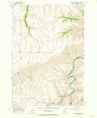
Deschutes River Lands Recreation Area defines the eastern landscape of this Oregon quadrangle, where the Deschutes River carves a deep path through the plateau. This 1962 survey, updated with 1980s photorevisions, captures the intersection of heavy transport and rural life along the Wasco and Sherman County line. The historic crossing at Sherars Bridge remains a focal point for the small settlement of Sherar, which served as a vital link over the river.
Find a feature on this map
26 named features on this map. Tap any name to fly to it.
Don’t see what you’re looking for? This feature index may not catch every label — zoom into the map to look around manually.
Map Details
Editions of this 1962 Sherars Bridge Map
Other maps of this area

1930 · Dufur
USGS Topo · 1:125,000

1934 · Dufur
USGS Topo · 1:125,000

1953 · The Dalles
USGS Topo · 1:250,000

1956 · The Dalles
USGS Topo · 1:250,000

1957 · The Dalles
USGS Topo · 1:250,000

1962 · Postage Stamp Butte
USGS Topo · 1:24,000

1962 · Summit Ridge
USGS Topo · 1:24,000

1962 · Dufur East
USGS Topo · 1:24,000

1962 · Sinamox
USGS Topo · 1:24,000
1962 · Tygh Valley
USGS Topo · 1:24,000