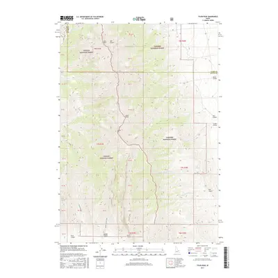
2017 Map of Tyler Peak
USGS Topo · Published 2017About this map
Tyler Peak and Saddle Mtn anchor the high-elevation divide where the Challis National Forest meets the Targhee National Forest. This section of the southern Lemhi Range shows a landscape defined by sharp topographical relief and a network of drainages such as Middle Fork Kyle Canyon and Tyler Canyon. The map reveals the early 21st-century state of the land's administrative and recreational access, with the N Creek Trail and Middle Canyon Trail following the deep cuts of the terrain. The inclusion of Kyle Spring and the seasonally varying S Creek highlights the importance of water sources in this arid high-country environment. The boundary line between Butte and Clark Counties runs through the northern portion, cutting across ridges and canyon floors.
Find a feature on this map
48 named features on this map. Tap any name to fly to it.
Don’t see what you’re looking for? This feature index may not catch every label — zoom into the map to look around manually.
Map Details
Editions of this 2017 Tyler Peak Map
This is the sole edition of this map. No revisions or reprints were ever made.
Other maps of this area

1955 · Dubois
USGS Topo · 1:250,000

1955 · Idaho Falls
USGS Topo · 1:250,000

1957 · Diamond Peak
USGS Topo · 1:62,500

1958 · Dubois
USGS Topo · 1:250,000

1958 · Idaho Falls
USGS Topo · 1:250,000

1969 · Little Lost River Sinks
USGS Topo · 1:24,000

1969 · Eightmile Canyon
USGS Topo · 1:24,000

1969 · Richard Butte
USGS Topo · 1:24,000

1969 · Tyler Peak
USGS Topo · 1:24,000

1969 · Howe
USGS Topo · 1:24,000