
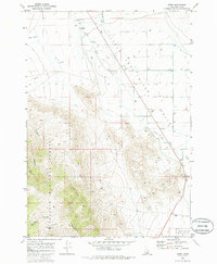
1969 Map of Howe
USGS Topo · Published 1973About this map
The Little Lost River Valley serves as the focal point of this Idaho survey, where the Little Lost River winds through a landscape defined by ranching infrastructure and high-desert terrain. The eastern edge of the Lost River Range rises sharply to the west, marked by significant elevations like Jumpoff Peak and deep incisions such as Horsethief Canyon and Jumpoff Canyon. This era shows the valley floor peppered with numerous irrigation wells and a complex network of Jeep Trails, indicating a landscape heavily utilized for water management and livestock movement.
Find a feature on this map
19 named features on this map. Tap any name to fly to it.
Don’t see what you’re looking for? This feature index may not catch every label — zoom into the map to look around manually.
Map Details
Editions of this 1969 Howe Map
2 editions found
Other maps of this area

1955 · Idaho Falls
USGS Topo · 1:250,000

1958 · Idaho Falls
USGS Topo · 1:250,000

1969 · Arco Pass
USGS Topo · 1:24,000

1969 · Little Lost River Sinks
USGS Topo · 1:24,000

1969 · Tyler Peak
USGS Topo · 1:24,000

1969 · Howe NW
USGS Topo · 1:24,000

1969 · Howe NE
USGS Topo · 1:24,000

1972 · Howe Peak
USGS Topo · 1:24,000

1972 · Arco Hills
USGS Topo · 1:24,000
1973 · Circular Butte 3 NW
USGS Topo · 1:24,000