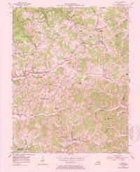
1976 Map of Tyner
USGS Topo · Published 1984About this map
The Cumberland National Forest dominates the northwestern portion of this Jackson County landscape, where the rugged terrain of the Appalachian Plateau is defined by deep-cut stream valleys. The community of Annville serves as a central hub along Pond Creek, while smaller settlements like Bond, Tyner, and Mildred are connected by a network of winding roads following the ridge lines and creek bottoms. This mid-century survey captures a rural Kentucky society organized around its local institutions, evidenced by the high density of country schools such as Blooming Grove Sch and the Collier Sch.
Find a feature on this map
56 named features on this map. Tap any name to fly to it.
Don’t see what you’re looking for? This feature index may not catch every label — zoom into the map to look around manually.
Map Details
Editions of this 1976 Tyner Map
This is the sole edition of this map. No revisions or reprints were ever made.
Other maps of this area

1891 · Manchester
USGS Topo · 1:125,000

1893 · London
USGS Topo · 1:125,000

1897 · London
USGS Topo · 1:125,000

1952 · Portersburg
USGS Topo · 1:24,000

1952 · Manchester
USGS Topo · 1:24,000

1952 · London
USGS Topo · 1:24,000

1953 · Mc Kee
USGS Topo · 1:24,000

1953 · Sandgap
USGS Topo · 1:24,000

1953 · Tyner
USGS Topo · 1:24,000

1953 · Parrot
USGS Topo · 1:24,000