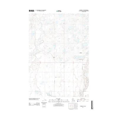
2013 Map of Tyonek B-1 NE
USGS Topo · Published 2013About this map
The Little Susitna River winds through this section of the Matanuska-Susitna Borough, defining a landscape dominated by dozens of small lakes and specialized aviation infrastructure. In this 2013 survey, the distribution of remote landing sites like Carpentiers Strip Airport, Point Mac Airport, and Robin's Landing Airport highlights the region's reliance on bush flying for connectivity. The terrain is marked by a naming convention reflecting local agriculture and livestock, seen in thoroughfares such as Ayrshire Ave, Guernsey Rd, Jersey Ave, and Brown Swiss Rd. Water bodies including Diamond Lake, Jewell Lake, and Carpenter Lake are scattered across the quadrangle, illustrating the complex hydrology typical of this Alaskan coastal plain before it meets the higher elevations toward the east along Point MacKenzie Rd.
Find a feature on this map
25 named features on this map. Tap any name to fly to it.
Don’t see what you’re looking for? This feature index may not catch every label — zoom into the map to look around manually.
Map Details
Editions of this 2013 Tyonek B-1 NE Map
This is the sole edition of this map. No revisions or reprints were ever made.
Other maps of this area

1949 · Tyonek
USGS Topo · 1:250,000

1950 · Anchorage C-8
USGS Topo · 1:63,360

1951 · Anchorage
USGS Topo · 1:250,000

1951 · Tyonek
USGS Topo · 1:250,000

1952 · Anchorage C-8
USGS Topo · 1:63,360

1952 · Tyonek C-1
USGS Topo · 1:63,360

1952 · Anchorage B-8
USGS Topo · 1:63,360

1953 · Anchorage B-8
USGS Topo · 1:63,360

1958 · Tyonek B-1
USGS Topo · 1:63,360

1958 · Tyonek C-1
USGS Topo · 1:63,360