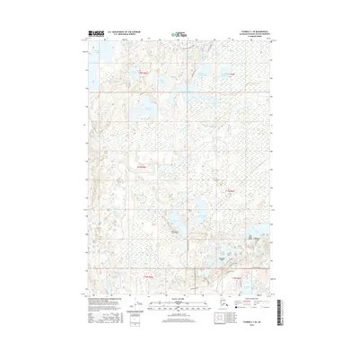
2016 Map of Tyonek C-1 SE
USGS Topo · Published 2016About this map
West Papoose Lake Airpark anchors a landscape defined by an intricate network of water and wilderness in the Matanuska-Susitna Borough. In the northern reaches, Red Shirt Lake and the James Lake Loop Canoe trail suggest a region deeply connected to bush aviation and recreational watercraft. The Little Susitna River meanders through the eastern portion of the survey, flowing past dozens of smaller water bodies including Buckley Lake Number One, Buckley Lake Number Two, and Skeetna Lake. Local transit is facilitated by a grid of specialized roads such as Susitna Parkway, Adams Drive, and Papoose Twins Road, which provide access to scattered residential clearings. The map illustrates a contemporary Alaskan settlement pattern where isolated homesites are situated among clusters of lakes like Crooked Lake, Mirror Lake, and Diamond Lake.
Find a feature on this map
41 named features on this map. Tap any name to fly to it.
Don’t see what you’re looking for? This feature index may not catch every label — zoom into the map to look around manually.
Map Details
Editions of this 2016 Tyonek C-1 SE Map
This is the sole edition of this map. No revisions or reprints were ever made.
Other maps of this area

1949 · Tyonek
USGS Topo · 1:250,000

1950 · Anchorage C-8
USGS Topo · 1:63,360

1951 · Anchorage
USGS Topo · 1:250,000

1951 · Tyonek
USGS Topo · 1:250,000

1952 · Anchorage C-8
USGS Topo · 1:63,360

1952 · Tyonek C-1
USGS Topo · 1:63,360

1952 · Anchorage B-8
USGS Topo · 1:63,360

1953 · Anchorage B-8
USGS Topo · 1:63,360

1958 · Tyonek B-1
USGS Topo · 1:63,360

1958 · Tyonek C-1
USGS Topo · 1:63,360