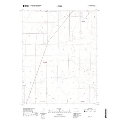
2019 Map of Tyrone
USGS Topo · Published 2019About this map
Tyrone sits at the heart of this high plains landscape in Las Animas County, serving as a focal point for a region defined by its wide plateaus and drainage networks. The terrain is characterized by broad expanses like Tyrone Flats and Adobe Flats, where the ground gradually slopes toward the seasonal waters of Van Bremer Arroyo. This 2019 survey documents a landscape that remains sparsely settled, yet connected by an extensive network of county roads such as Co RD 70 and Co RD 56.0. To the northeast, the settlement of Simpson appears alongside the Simpson Cemetery, offering a tangible link to the area's local history. The presence of the Pinon Canyon Airport and the 350 highway indicates the area's role in regional transit, while Browns Lake provides one of the few named water features in this semi-arid environment.
Find a feature on this map
26 named features on this map. Tap any name to fly to it.
Don’t see what you’re looking for? This feature index may not catch every label — zoom into the map to look around manually.
Map Details
Editions of this 2019 Tyrone Map
This is the sole edition of this map. No revisions or reprints were ever made.
Other maps of this area

1891 · Apishapa
USGS Topo · 1:125,000

1892 · Elmoro
USGS Topo · 1:125,000

1893 · Apishapa
USGS Topo · 1:125,000

1893 · Elmoro
USGS Topo · 1:125,000

1897 · Elmoro
USGS Topo · 1:125,000

1897 · Apishapa
USGS Topo · 1:125,000

1954 · Trinidad
USGS Topo · 1:250,000

1955 · Trinidad
USGS Topo · 1:250,000

1958 · Trinidad
USGS Topo · 1:250,000

1959 · Trinidad
USGS Topo · 1:250,000