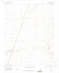
1971 Map of Tyrone
USGS Topo · Published 1973About this map
Tyrone Flats and Adobe Flats define this stretch of the High Plains as it appeared in the early 1970s. The landscape is marked by the historical intersection of frontier transit and industrial infrastructure, where the Santa Fe Trail and the Atchison Topeka and Santa Fe railroad run nearly parallel through the center of the sheet. Small agricultural and transportation hubs like Tyrone and Simpson anchor the northern portion of the map, while water resources such as Simpson Lake, Gyurman Reservoir, and Browns Lake punctuate the arid terrain. The drainage of Van Bremer Arroyo cuts across the southern flats, showing the natural hydrology that shaped local ranching and settlement. Evidence of local industry is visible through multiple Gravel Pits and a significant Pipeline crossing the southeast, illustrating how the land was utilized for both transit and resource extraction during this era.
Find a feature on this map
19 named features on this map. Tap any name to fly to it.
Don’t see what you’re looking for? This feature index may not catch every label — zoom into the map to look around manually.
Map Details
Editions of this 1971 Tyrone Map
This is the sole edition of this map. No revisions or reprints were ever made.
Other maps of this area

1891 · Apishapa
USGS Topo · 1:125,000

1892 · Elmoro
USGS Topo · 1:125,000

1893 · Apishapa
USGS Topo · 1:125,000

1893 · Elmoro
USGS Topo · 1:125,000

1897 · Elmoro
USGS Topo · 1:125,000

1897 · Apishapa
USGS Topo · 1:125,000

1954 · Trinidad
USGS Topo · 1:250,000

1955 · Trinidad
USGS Topo · 1:250,000

1958 · Trinidad
USGS Topo · 1:250,000

1959 · Trinidad
USGS Topo · 1:250,000