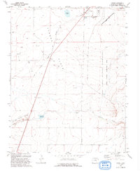
1993 Map of Tyrone
USGS Topo · Published 1993About this map
Tyrone Flats and Adobe Flats define this stretch of the high plains, where the Santa Fe National Historic Trail (Approximate) cuts a diagonal path across the landscape. The map captures a transition in land use during the early 1990s, dominated by the sprawling boundaries of the Fort Carson Military Reservation (Piñon Canyon Maneuver Site). While the rail lines that once fueled regional growth are absent, the geography of settlement remains visible through the small communities of Tyrone and Simpson. Water management is central to life in this arid environment, evidenced by scattered improvements such as Gyurman Reservoir, Simpson Lake, and Browns Lake along the Van Bremer Arroyo. Local genealogy is anchored by the Simpson Cem, which sits near the northern boundary of the maneuvers site, offering a tangible link to the families who established these ranching outposts before the military expansion.
Find a feature on this map
18 named features on this map. Tap any name to fly to it.
Don’t see what you’re looking for? This feature index may not catch every label — zoom into the map to look around manually.
Map Details
Editions of this 1993 Tyrone Map
This is the sole edition of this map. No revisions or reprints were ever made.
Other maps of this area

1891 · Apishapa
USGS Topo · 1:125,000

1892 · Elmoro
USGS Topo · 1:125,000

1893 · Apishapa
USGS Topo · 1:125,000

1893 · Elmoro
USGS Topo · 1:125,000

1897 · Elmoro
USGS Topo · 1:125,000

1897 · Apishapa
USGS Topo · 1:125,000

1954 · Trinidad
USGS Topo · 1:250,000

1955 · Trinidad
USGS Topo · 1:250,000

1958 · Trinidad
USGS Topo · 1:250,000

1959 · Trinidad
USGS Topo · 1:250,000