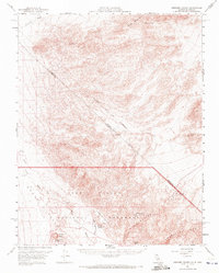
1957 Map of Ubehebe Crater
USGS Topo · Published 1972About this map
Scottys Castle stands as a prominent landmark in the northern reaches of Death Valley National Monument, centered in a landscape defined by dramatic geological formations and early 20th-century history. This 1957 survey captures the area around Scottys Ranch and the vital water sources at Grapevine Springs and Surprise Sprs, which were essential for survival in the arid terrain. To the west, the volcanic history of the region is evident at Ubehebe Crater and its smaller neighbor Little Hebe Crater. The map also details the rugged heights of Gold Mountain and the Grapevine Mountains, where scattered shafts, tunnels, and prospects indicate a history of mining exploration. Notable surveyor lines, including the Von Schmidt Line, cross this remote borderland between California and Nevada, marking early efforts to define the boundary through Death Valley.
Find a feature on this map
28 named features on this map. Tap any name to fly to it.
Don’t see what you’re looking for? This feature index may not catch every label — zoom into the map to look around manually.
Map Details
Editions of this 1957 Ubehebe Crater Map
2 editions found

Other maps of this area

1908 · Lida
USGS Topo · 1:250,000

1908 · Ballarat
USGS Topo · 1:250,000

1913 · Lida
USGS Topo · 1:250,000

1913 · Ballarat
USGS Topo · 1:250,000

1948 · Death Valley
USGS Topo · 1:250,000

1954 · Death Valley
USGS Topo · 1:250,000

1954 · Goldfield
USGS Topo · 1:250,000

1955 · Goldfield
USGS Topo · 1:250,000

1956 · Death Valley
USGS Topo · 1:250,000

1957 · Death Valley
USGS Topo · 1:250,000