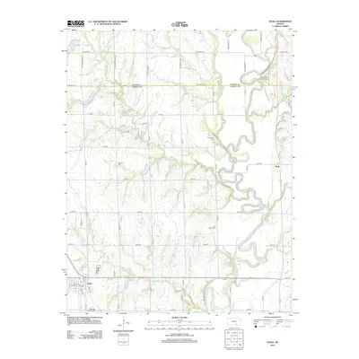
2012 Map of Udall
USGS Topo · Published 2012About this map
The town of Udall anchors the southwestern corner of this agricultural landscape in Cowley County, situated just north of the Cherokee Strip Airport. The terrain is defined by the winding course of the Walnut River in the east and a network of prairie tributaries including Polecat Cr, Stewart Cr, and Eightmile Cr. This 2012 survey illustrates the grid of rural roads, such as SW Indiana La Rd and SW Meadowlark Rd, which connect isolated homesteads and local landmarks. Genealogists will find several notable burial sites throughout the township, including Red Bud Cem near the center and Star Valley Cem further south. The small settlement of Rock sits on the eastern edge of the quadrangle, serving as a secondary local hub along the banks of Rock Cr.
Find a feature on this map
52 named features on this map. Tap any name to fly to it.
Don’t see what you’re looking for? This feature index may not catch every label — zoom into the map to look around manually.
Map Details
Editions of this 2012 Udall Map
This is the sole edition of this map. No revisions or reprints were ever made.
Other maps of this area

1888 · Eldorado
USGS Topo · 1:125,000

1889 · Burden
USGS Topo · 1:125,000

1889 · Wichita
USGS Topo · 1:125,000

1890 · Wellington
USGS Topo · 1:125,000

1894 · Wichita
USGS Topo · 1:125,000

1955 · Udall
USGS Topo · 1:24,000

1955 · Rose Hill
USGS Topo · 1:24,000

1955 · Mulvane
USGS Topo · 1:24,000

1955 · Douglass
USGS Topo · 1:24,000

1955 · Wichita
USGS Topo · 1:250,000