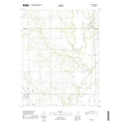
2018 Map of Udall
USGS Topo · Published 2018About this map
The Walnut River winds through the eastern portion of this Kansas landscape, serving as a primary drainage for numerous tributaries including Eightmile Creek and Muddy Creek. The town of Udall anchors the southwestern corner, showing a structured grid of streets such as West Lewis Street and West Second Street. This survey documents a rural environment where land use is dictated by the section lines of the Public Land Survey System, with many local roads following these established boundaries.
Find a feature on this map
58 named features on this map. Tap any name to fly to it.
Don’t see what you’re looking for? This feature index may not catch every label — zoom into the map to look around manually.
Map Details
Editions of this 2018 Udall Map
This is the sole edition of this map. No revisions or reprints were ever made.
Other maps of this area

1888 · Eldorado
USGS Topo · 1:125,000

1889 · Burden
USGS Topo · 1:125,000

1889 · Wichita
USGS Topo · 1:125,000

1890 · Wellington
USGS Topo · 1:125,000

1894 · Wichita
USGS Topo · 1:125,000

1955 · Udall
USGS Topo · 1:24,000

1955 · Rose Hill
USGS Topo · 1:24,000

1955 · Mulvane
USGS Topo · 1:24,000

1955 · Douglass
USGS Topo · 1:24,000

1955 · Wichita
USGS Topo · 1:250,000