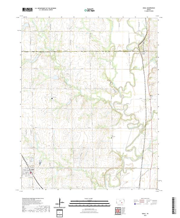
2022 Map of Udall
USGS Topo · Published 2022About this map
Udall and the northern reaches of Cowley County are defined by the winding course of the Walnut River, which carves a deep valley through the prairie landscape. The area south of the Butler County line is characterized by a dense network of local section roads and numerous watercourses, including Polecat Creek, Stewart Cr, and Muddy Creek. The small community of Rock sits in the northeast, positioned where the terrain transitions toward the river bottomlands.
Find a feature on this map
68 named features on this map. Tap any name to fly to it.
Don’t see what you’re looking for? This feature index may not catch every label — zoom into the map to look around manually.
Map Details
Editions of this 2022 Udall Map
This is the sole edition of this map. No revisions or reprints were ever made.
Other maps of this area

1888 · Eldorado
USGS Topo · 1:125,000

1889 · Burden
USGS Topo · 1:125,000

1889 · Wichita
USGS Topo · 1:125,000

1890 · Wellington
USGS Topo · 1:125,000

1894 · Wichita
USGS Topo · 1:125,000

1955 · Udall
USGS Topo · 1:24,000

1955 · Rose Hill
USGS Topo · 1:24,000

1955 · Mulvane
USGS Topo · 1:24,000

1955 · Douglass
USGS Topo · 1:24,000

1955 · Wichita
USGS Topo · 1:250,000