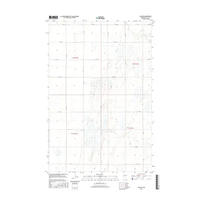
2016 Map of Ulen SW
USGS Topo · Published 2016About this map
S Br Wild Rice River meanders across the northeast corner of this Clay County landscape, part of a drainage system that includes Felton Cr further south. The terrain is defined by a rigorous section-line grid, typical of the Red River Valley region, where long, straight avenues like 190th Ave N and 180th Ave N facilitate movement through large agricultural tracts. This 2016 survey highlights the intersection of local infrastructure and natural hydrology, showing how county roads such as Co Hwy 40 and Co Rd 112 navigate the wetland-rich environment.
Find a feature on this map
16 named features on this map. Tap any name to fly to it.
Don’t see what you’re looking for? This feature index may not catch every label — zoom into the map to look around manually.
Map Details
Editions of this 2016 Ulen SW Map
This is the sole edition of this map. No revisions or reprints were ever made.
Other maps of this area

1895 · Fargo
USGS Topo · 1:125,000

1897 · Fargo
USGS Topo · 1:125,000

1918 · Ulen
USGS Topo · 1:62,500

1919 · Hawley
USGS Topo · 1:62,500

1952 · Grand Forks
USGS Topo · 1:250,000

1953 · Fargo
USGS Topo · 1:250,000

1956 · Fargo
USGS Topo · 1:250,000

1956 · Grand Forks
USGS Topo · 1:250,000
1964 · Glyndon North
USGS Topo · 1:24,000

1965 · Syre
USGS Topo · 1:24,000