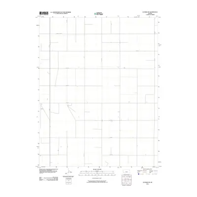
2010 Map of Ulysses NE
USGS Topo · Published 2010About this map
State Hwy 25 serves as the primary north-south artery through this section of the High Plains, slicing through a landscape defined by an orderly grid of section-line roads. The topography of Grant County here is notably flat, allowing for the precise geometry of County Line Rd and numerous lateral routes such as Co Rd 4 and Co Rd 8. This 2010 survey reflects the enduring agricultural and industrial framework of western Kansas, where water management is critical to the local economy. A solitary Well is marked in the eastern portion of the quadrangle, a vital reference point for researchers tracing land use and resource extraction in Sherman Township. The map provides a clear look at the intersection of rural infrastructure, with routes like Co Rd L and N Rd M establishing the surveyed bounds of the prairie.
Find a feature on this map
16 named features on this map. Tap any name to fly to it.
Don’t see what you’re looking for? This feature index may not catch every label — zoom into the map to look around manually.
Map Details
Editions of this 2010 Ulysses NE Map
This is the sole edition of this map. No revisions or reprints were ever made.
Other maps of this area

1891 · Larned
USGS Topo · 1:125,000

1900 · Lakin
USGS Topo · 1:125,000

1955 · Dodge City
USGS Topo · 1:250,000

1958 · Dodge City
USGS Topo · 1:250,000

1959 · Dodge City
USGS Topo · 1:250,000

1959 · Ulysses NW
USGS Topo · 1:24,000

1959 · Ulysses
USGS Topo · 1:24,000

1959 · Ulysses NE
USGS Topo · 1:24,000

1959 · Hickok NW
USGS Topo · 1:24,000
1959 · Ulysses SW
USGS Topo · 1:24,000