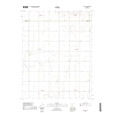
2018 Map of Ulysses NE
USGS Topo · Published 2018About this map
Lakin Draw meanders through the heart of this High Plains landscape, defining the local topography in an otherwise highly organized agricultural grid. This modern survey illustrates the expansive rural layout of Sherman Township, where the transition between Kearny and Grant counties is marked by Co Line Rd. The landscape is characterized by a precise network of section lines and gravel thoroughfares, including Co Rd L and Lakin Ln, which facilitate the region's vast farming operations. The map documents the enduring Public Land Survey System structure, with Township and Range divisions such as t27s r36w remaining the primary framework for land ownership and management in this part of western Kansas.
Find a feature on this map
19 named features on this map. Tap any name to fly to it.
Don’t see what you’re looking for? This feature index may not catch every label — zoom into the map to look around manually.
Map Details
Editions of this 2018 Ulysses NE Map
This is the sole edition of this map. No revisions or reprints were ever made.
Other maps of this area

1891 · Larned
USGS Topo · 1:125,000

1900 · Lakin
USGS Topo · 1:125,000

1955 · Dodge City
USGS Topo · 1:250,000

1958 · Dodge City
USGS Topo · 1:250,000

1959 · Dodge City
USGS Topo · 1:250,000

1959 · Ulysses NW
USGS Topo · 1:24,000

1959 · Ulysses
USGS Topo · 1:24,000

1959 · Ulysses NE
USGS Topo · 1:24,000

1959 · Hickok NW
USGS Topo · 1:24,000
1959 · Ulysses SW
USGS Topo · 1:24,000