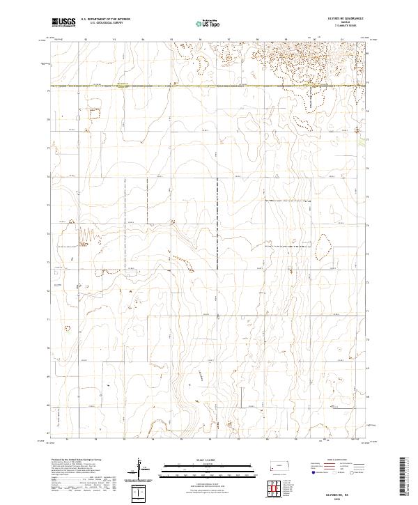
2022 Map of Ulysses NE
USGS Topo · Published 2022About this map
Lakin Draw defines the central topography of this section of the High Plains, carving a distinct drainage path through the open agricultural landscape. The boundary between Kearny Co and Grant Co bisects the northern reach of the sheet, marked by the long stretch of Co Line Rd. This map reveals a meticulous grid of rural transport, where local routes like Co Rd 2 and N Rd K serve as the primary infrastructure for the region's expansive farming operations. The spatial organization of the townships, including t27s r37w and t26s r36w, illustrates the enduring influence of the Public Land Survey System on Kansas land use. While predominantly open country, the map identifies specific local landmarks such as Lakin Ln and Co Rd 5 W, which provide essential orientation for genealogists and local historians tracing family homesteads in the western part of the state.
Find a feature on this map
25 named features on this map. Tap any name to fly to it.
Don’t see what you’re looking for? This feature index may not catch every label — zoom into the map to look around manually.
Map Details
Editions of this 2022 Ulysses NE Map
This is the sole edition of this map. No revisions or reprints were ever made.
Other maps of this area

1891 · Larned
USGS Topo · 1:125,000

1900 · Lakin
USGS Topo · 1:125,000

1955 · Dodge City
USGS Topo · 1:250,000

1958 · Dodge City
USGS Topo · 1:250,000

1959 · Dodge City
USGS Topo · 1:250,000

1959 · Ulysses NW
USGS Topo · 1:24,000

1959 · Ulysses
USGS Topo · 1:24,000

1959 · Ulysses NE
USGS Topo · 1:24,000

1959 · Hickok NW
USGS Topo · 1:24,000
1959 · Ulysses SW
USGS Topo · 1:24,000