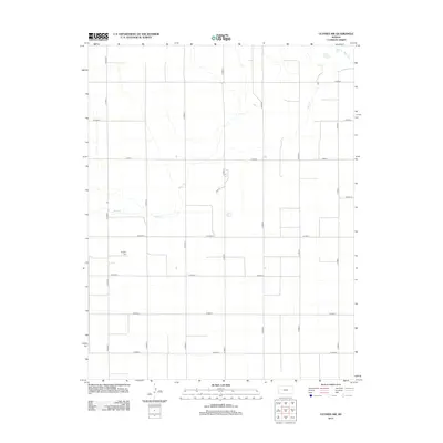
2012 Map of Ulysses NW
USGS Topo · Published 2012About this map
Shockey Cem sits at the heart of this High Plains landscape, serving as a primary point of interest for genealogists and local historians in this portion of Grant County. The terrain is defined by the ephemeral courses of Bear Ck and Wolf Cr, which carve subtle drainage patterns across the agricultural grid. This 2012 survey illustrates the highly organized section-line road system characteristic of western Kansas, where routes like N Road C and W Road 8 facilitate the movement of equipment and grain. A curious break in the numeric naming convention appears with the short segment of Easy St near the center of the sheet. The map documents the enduring infrastructure of a rural farming township, where the placement of cemeteries and the management of creek beds remain the most significant landmarks on the horizon.
Find a feature on this map
21 named features on this map. Tap any name to fly to it.
Don’t see what you’re looking for? This feature index may not catch every label — zoom into the map to look around manually.
Map Details
Editions of this 2012 Ulysses NW Map
This is the sole edition of this map. No revisions or reprints were ever made.
Other maps of this area

1891 · Larned
USGS Topo · 1:125,000

1900 · Syracuse
USGS Topo · 1:125,000

1900 · Lakin
USGS Topo · 1:125,000

1920 · Syracuse
USGS Topo · 1:125,000

1955 · Dodge City
USGS Topo · 1:250,000

1958 · Dodge City
USGS Topo · 1:250,000

1959 · Dodge City
USGS Topo · 1:250,000

1959 · Ulysses NW
USGS Topo · 1:24,000

1959 · Big Bow NE
USGS Topo · 1:24,000

1959 · Ulysses
USGS Topo · 1:24,000