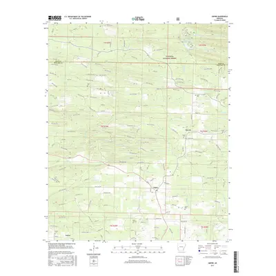
2017 Map of Umpire
USGS Topo · Published 2017About this map
The Saline River and its various tributaries, including the S Fork Saline River and E Saline Cr, define the drainage patterns of this portion of the Ouachita National Forest. Settlements such as Umpire and Mineola serve as local hubs in a landscape heavily marked by timber access roads, including an extensive network of Weyco routes. At the northern edge, Shady Lake provides a distinct water feature within the forest boundaries. Local history is anchored by numerous small burial grounds dispersed across the townships, such as Cedar Hill Cem, Section Cem, and Union Cem, which often represent the only remaining physical markers of early community centers in this timber-rich region. The map also traces the boundary between Polk and Howard Counties, showing how the topography of ridges like Battle Hill influenced early road placement.
Find a feature on this map
129 named features on this map. Tap any name to fly to it.
Don’t see what you’re looking for? This feature index may not catch every label — zoom into the map to look around manually.
Map Details
Editions of this 2017 Umpire Map
This is the sole edition of this map. No revisions or reprints were ever made.
Other maps of this area

1906 · Caddo Gap
USGS Topo · 1:125,000

1913 · De Queen
USGS Topo · 1:125,000

1936 · Athens
USGS Topo · 1:48,000

1942 · Athens
USGS Topo · 1:62,500

1950 · Mcalester
USGS Topo · 1:250,000

1955 · Little Rock
USGS Topo · 1:250,000

1956 · Little Rock
USGS Topo · 1:250,000

1959 · Umpire
USGS Topo · 1:62,500

1960 · Little Rock
USGS Topo · 1:250,000

1962 · McAlester
USGS Topo · 1:250,000