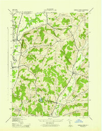
1945 Map of Unadilla Forks
USGS Topo · Published 1945About this map
Unadilla River and its valley serve as the geographic anchor for this 1943 survey, mapping the borderlands where Otsego, Madison, and Herkimer counties meet. The settlement of Unadilla Forks sits at the northern confluence, supported by the rail connection at River Forks Station and the manufacturing presence in Leonardsville. The landscape transitions from the river flats into the high ground of Mt Markham and Noah Rump, where a network of rural hamlets like Plainfield Center and Spooner Corners define the upland interior. Genealogists will find a wealth of family-named cemeteries and landmarks scattered across the township divisions of Winfield, Plainfield, and Edmeston, including Huntly Cem and Wood Cem. The presence of small water bodies like Summit Lake and winding streams such as Wharton Creek and Welch Creek illustrates the complex drainage pattern that shaped the early road networks and mill placements in this central New York region.
Find a feature on this map
40 named features on this map. Tap any name to fly to it.
Don’t see what you’re looking for? This feature index may not catch every label — zoom into the map to look around manually.
Map Details
Editions of this 1945 Unadilla Forks Map
This is the sole edition of this map. No revisions or reprints were ever made.
Other maps of this area

1907 · Winfield
USGS Topo · 1:62,500

1907 · Sangerfield
USGS Topo · 1:62,500

1910 · Hartwick
USGS Topo · 1:62,500

1910 · New Berlin
USGS Topo · 1:62,500

1912 · New Berlin
USGS Topo · 1:62,500

1912 · Hartwick
USGS Topo · 1:62,500

1943 · Schuyler Lake
USGS Topo · 1:24,000

1943 · New Berlin North
USGS Topo · 1:24,000

1943 · Millers Mills
USGS Topo · 1:24,000

1943 · Cassville
USGS Topo · 1:24,000