
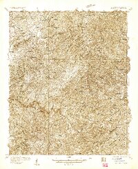
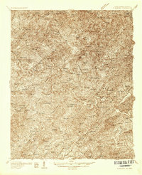
1934 Map of Unaka
USGS Topo · Published 1934About this map
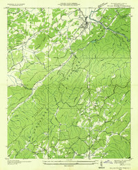
The Hiwassee River snakes through the heart of the Cherokee National Forest in this 1934 survey, a moment when the Tennessee Valley Authority was actively reshaping the region's hydrography. This document, overseen by Arthur E. Morgan and Carl A. Bock, captures the isolated communities of Unaka and Ogreeta before modern development. The presence of CCC Camp No F 11 along the Joe Brown Highway reflects the New Deal era labor and conservation efforts within the Beaverdam Mountains.
Find a feature on this map
71 named features on this map. Tap any name to fly to it.
Don’t see what you’re looking for? This feature index may not catch every label — zoom into the map to look around manually.
Map Details
Editions of this 1934 Unaka Map
This is the sole edition of this map. No revisions or reprints were ever made.
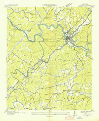
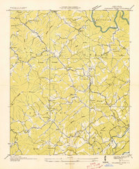
Other maps of this area

1893 · Murphy
USGS Topo · 1:125,000

1914 · Murphy
USGS Topo · 1:125,000

1927 · Big Junction
USGS Topo · 1:24,000
1933 · Haw Knob
USGS Topo · 1:48,000

1933 · Bald River Falls
USGS Topo · 1:24,000
1934 · Murphy
USGS Topo · 1:24,000
1934 · Persimmon Creek
USGS Topo · 1:24,000

1934 · McDaniel Bald
USGS Topo · 1:24,000
1934 · Murphy
USGS Topo · 1:48,000
1934 · Tellico Plains
USGS Topo · 1:24,000