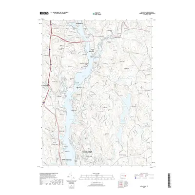
2018 Map of Uncasville
USGS Topo · Published 2018About this map
The Thames River corridor serves as the primary artery through this coastal Connecticut landscape, connecting Norwich in the north to the northern reaches of New London in the south. The riverbank is densely marked by historical points of interest, including the prominent Fort Point and a series of distinct landings and necks such as Brewster Neck and Massapeag Neck. Moving away from the water, the terrain rises into significant elevations like Mohegan Hill and Haughten Mtn, while the presence of Cochegan Rock highlights the area's glacial geology.
Find a feature on this map
128 named features on this map. Tap any name to fly to it.
Don’t see what you’re looking for? This feature index may not catch every label — zoom into the map to look around manually.
Map Details
Editions of this 2018 Uncasville Map
This is the sole edition of this map. No revisions or reprints were ever made.
Other maps of this area

1889 · Stonington
USGS Topo · 1:62,500

1889 · Moosup
USGS Topo · 1:62,500

1892 · New London
USGS Topo · 1:62,500

1892 · Norwich
USGS Topo · 1:62,500

1893 · Moosup
USGS Topo · 1:62,500

1893 · Stonington
USGS Topo · 1:62,500

1893 · New London
USGS Topo · 1:62,500

1920 · Moosup
USGS Topo · 1:62,500

1921 · New London
USGS Topo · 1:62,500

1921 · Stonington
USGS Topo · 1:62,500