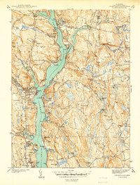
1941 Map of Uncasville
USGS Topo · Published 1941About this map
The Thames River serves as the central artery of this 1938 survey, revealing a landscape defined by maritime heritage and institutional development just before the United States entered World War II. Along its banks, the Submarine Base and U.S. Naval Reservation represent the significant military presence in the New London area. The river is also a hub for collegiate athletics, notably featuring both the Yale Boathouse and Harvard Boathouse near Gales Ferry.
Find a feature on this map
114 named features on this map. Tap any name to fly to it.
Don’t see what you’re looking for? This feature index may not catch every label — zoom into the map to look around manually.
Map Details
Editions of this 1941 Uncasville Map
2 editions found
Other maps of this area

1889 · Stonington
USGS Topo · 1:62,500

1889 · Moosup
USGS Topo · 1:62,500

1892 · New London
USGS Topo · 1:62,500

1892 · Norwich
USGS Topo · 1:62,500

1893 · Moosup
USGS Topo · 1:62,500

1893 · Stonington
USGS Topo · 1:62,500

1893 · New London
USGS Topo · 1:62,500

1920 · Moosup
USGS Topo · 1:62,500

1921 · New London
USGS Topo · 1:62,500

1921 · Stonington
USGS Topo · 1:62,500