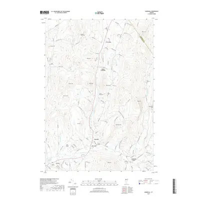
2018 Map of Underhill
USGS Topo · Published 2018About this map
Underhill Center and Riverside sit at the foot of the Green Mountains on this 2018 survey, reflecting the long-established settlement pattern along the Browns River. The landscape is defined by its numerous family-named peaks and ridges, such as Duffy Hill, McLean Hill, and Metcalf Hill, which partition the drainage basins of Roaring Brook and Beaver Brook. Genealogists and local historians will find a high concentration of burial sites throughout the township, including the Irish Settlement Cem to the east and Castle Cem near the western border. The map also records smaller communities like Cloverdale and North Underhill, as well as specialized landmarks like the Davis Private Airport. These details illustrate the transition from a mountainous rural interior to the more concentrated valley floors that have served as the region's population centers for generations.
Find a feature on this map
111 named features on this map. Tap any name to fly to it.
Don’t see what you’re looking for? This feature index may not catch every label — zoom into the map to look around manually.
Map Details
Editions of this 2018 Underhill Map
This is the sole edition of this map. No revisions or reprints were ever made.
Other maps of this area

1906 · Burlington
USGS Topo · 1:62,500

1913 · Milton
USGS Topo · 1:48,000

1915 · Milton
USGS Topo · 1:62,500

1919 · Burlington
USGS Topo · 1:62,500

1921 · Richmond
USGS Topo · 1:48,000

1924 · Camels Hump
USGS Topo · 1:62,500

1925 · Mount Mansfield
USGS Topo · 1:48,000

1927 · Mount Mansfield
USGS Topo · 1:62,500

1944 · Milton
USGS Topo · 1:62,500

1944 · Mount Mansfield
USGS Topo · 1:62,500