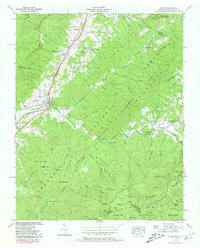
1939 Map of Unicoi
USGS Topo · Published 1979About this map
Buffalo Mountain and the Cherokee Mountains dominate this 1939 survey, framing the settled corridors of Unicoi and Limestone Cove. The Clinchfield Railroad and the path of Buffalo Creek define the local transport network, linking small communities like Marbleton and Shadtown to the wider region. High-elevation landmarks such as Unaka Mtn and Pinnacle Mtn, featuring a Lookout Tower, indicate the area's role in forest management within the Cherokee National Forest.
Find a feature on this map
83 named features on this map. Tap any name to fly to it.
Don’t see what you’re looking for? This feature index may not catch every label — zoom into the map to look around manually.
Map Details
Editions of this 1939 Unicoi Map
4 editions found
Other maps of this area

1891 · Roan Mountain
USGS Topo · 1:125,000

1894 · Roan Mountain
USGS Topo · 1:125,000

1904 · Roan Mountain
USGS Topo · 1:125,000

1934 · Bakersville
USGS Topo · 1:24,000

1934 · Iron Mtn Gap
USGS Topo · 1:24,000

1935 · Watauga Valley
USGS Topo · 1:48,000

1935 · Chestoa
USGS Topo · 1:24,000

1935 · Erwin
USGS Topo · 1:24,000

1935 · Huntdale
USGS Topo · 1:24,000

1935 · Elizabethton
USGS Topo · 1:24,000