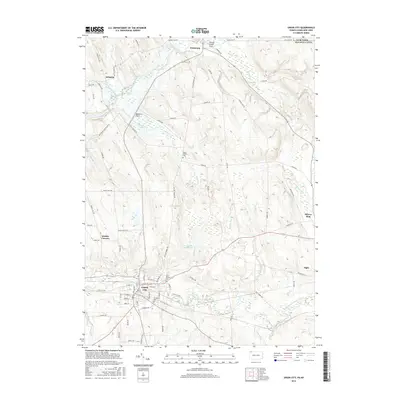
2016 Map of Union City
USGS Topo · Published 2016About this map
Union City serves as the primary hub in this southern Erie County landscape, where the South Branch French Creek meets local transportation corridors. The town's grid is well-defined, containing several historical points of interest for genealogists, such as Saint Teresa Cem and Evergreen Cem. Moving north toward the New York state line, the terrain opens into the French Creek Flats near the settlement of Wattsburg. This area is characterized by a network of drainage features like Lake Pleasant Outlet and Hubbel Run, which flow through the agricultural valley. Smaller rural clusters such as Arbuckle and Kimble Corners are connected by a web of named roads including Hatch Hollow Rd and Old Wattsburg Rd, illustrating the persistent 19th-century settlement patterns that remain visible in the modern era.
Find a feature on this map
75 named features on this map. Tap any name to fly to it.
Don’t see what you’re looking for? This feature index may not catch every label — zoom into the map to look around manually.
Map Details
Editions of this 2016 Union City Map
This is the sole edition of this map. No revisions or reprints were ever made.
Other maps of this area

1905 · Clymer
USGS Topo · 1:62,500

1913 · North East
USGS Topo · 1:62,500

1915 · North East
USGS Topo · 1:62,500

1929 · Corry
USGS Topo · 1:48,000

1929 · Union City
USGS Topo · 1:62,500

1932 · Corry
USGS Topo · 1:62,500

1932 · Union City
USGS Topo · 1:62,500

1939 · Clymer
USGS Topo · 1:62,500

1941 · Clymer
USGS Topo · 1:62,500

1943 · North East
USGS Topo · 1:62,500