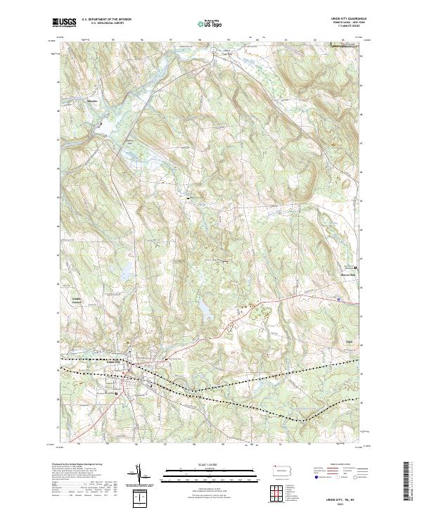
2023 Map of Union City
USGS Topo · Published 2023About this map
Union City serves as the primary hub in this corner of Erie County, where the South Branch French Creek meets Bentley Run. This modern survey documents a landscape defined by the intersection of traditional settlements and intricate water systems, including the complex wetlands of Titus Bog and French Creek Flats. Local history and genealogy are well-represented by several established burial grounds such as Thompson Pioneer Cem, Saint Teresa Cem, and Evergreen Cem, which cluster around the main township center.
Find a feature on this map
92 named features on this map. Tap any name to fly to it.
Don’t see what you’re looking for? This feature index may not catch every label — zoom into the map to look around manually.
Map Details
Editions of this 2023 Union City Map
This is the sole edition of this map. No revisions or reprints were ever made.
Other maps of this area

1905 · Clymer
USGS Topo · 1:62,500

1913 · North East
USGS Topo · 1:62,500

1915 · North East
USGS Topo · 1:62,500

1929 · Corry
USGS Topo · 1:48,000

1929 · Union City
USGS Topo · 1:62,500

1932 · Corry
USGS Topo · 1:62,500

1932 · Union City
USGS Topo · 1:62,500

1939 · Clymer
USGS Topo · 1:62,500

1941 · Clymer
USGS Topo · 1:62,500

1943 · North East
USGS Topo · 1:62,500