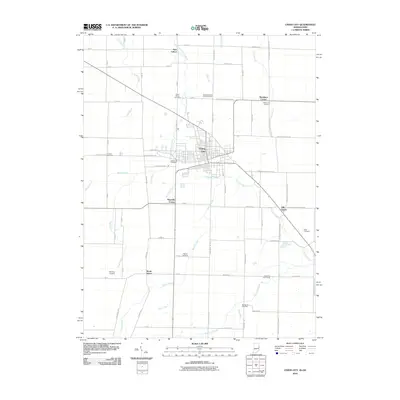
2010 Map of Union City
USGS Topo · Published 2010About this map
Union City serves as the focal point of this 2010 survey, straddling the border between Indiana and Ohio with a grid that reflects its dual-state identity. The landscape is defined by the convergence of agricultural drainage and natural waterways, including the Little Mississinewa River and Dismal Creek, which wind through the surrounding farmland. Smaller hamlets and rural junctions like New Lisbon, South Salem, and Hill Grove provide important geographic anchors for the region's history.
Find a feature on this map
71 named features on this map. Tap any name to fly to it.
Don’t see what you’re looking for? This feature index may not catch every label — zoom into the map to look around manually.
Map Details
Editions of this 2010 Union City Map
This is the sole edition of this map. No revisions or reprints were ever made.
Other maps of this area

1908 · St. Henry
USGS Topo · 1:62,500

1915 · Fort Recovery
USGS Topo · 1:48,000

1916 · Winchester
USGS Topo · 1:48,000

1918 · Winchester
USGS Topo · 1:62,500

1918 · Fort Recovery
USGS Topo · 1:62,500

1943 · Winchester
USGS Topo · 1:62,500

1953 · Muncie
USGS Topo · 1:250,000

1956 · Muncie
USGS Topo · 1:250,000

1960 · Union City
USGS Topo · 1:24,000
1960 · Spartanburg
USGS Topo · 1:24,000