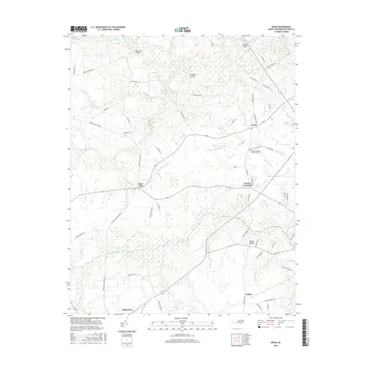
2016 Map of Union
USGS Topo · Published 2016About this map
Union and the surrounding rural communities of Hertford County are defined by a complex network of slow-moving coastal plain waterways and localized crossroads settlements. The landscape is dominated by the broad basins of Ahoskie Creek and Cutawhiskie Cr, which create intricate wetland patterns between higher ground. Educational infrastructure is anchored by the Roanoke-Chowan Community Coll located near the eastern edge of the survey area. Small, named locales like Fraziers Crossroads, Saint John, and the interestingly named Poor Town illustrate the traditional settlement patterns of the Inner Banks region. Further south, the community of Millennium sits near the edge of the sheet, while northern landmarks like Benthalls Bridge and Knights Bridge provide historical crossing points over the winding Potecasi Cr. The map also highlights family-named terrain features such as Buffalo Island, tucked between creek branches.
Find a feature on this map
64 named features on this map. Tap any name to fly to it.
Don’t see what you’re looking for? This feature index may not catch every label — zoom into the map to look around manually.
Map Details
Editions of this 2016 Union Map
This is the sole edition of this map. No revisions or reprints were ever made.
Other maps of this area

1908 · Winton
USGS Topo · 1:62,500

1953 · Norfolk
USGS Topo · 1:250,000

1972 · Aulander
USGS Topo · 1:24,000
1973 · Murfreesboro
USGS Topo · 1:24,000
1973 · Conway
USGS Topo · 1:24,000

1973 · Kelford
USGS Topo · 1:24,000

1977 · Union
USGS Topo · 1:24,000

1977 · Woodland
USGS Topo · 1:24,000

1982 · Powellsville
USGS Topo · 1:24,000
1982 · Winton
USGS Topo · 1:24,000