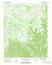
1968 Map of Union Hill
USGS Topo · Published 1971About this map
The borderlands of Clay County, Tennessee, and Monroe County, Kentucky, are defined by a winding network of ridges and stream valleys as they appeared in the late 1960s. Central to the area is Union Hill, a small settlement positioned between the deep drainages of the Left Fork Brimstone Creek and the Right Fork Brimstone Creek. The landscape is dotted with rural crossroads and family-named landmarks that offer significant value for genealogical research, including Miles Crossroads and Cherry Crossroads.
Find a feature on this map
36 named features on this map. Tap any name to fly to it.
Don’t see what you’re looking for? This feature index may not catch every label — zoom into the map to look around manually.
Map Details
Editions of this 1968 Union Hill Map
This is the sole edition of this map. No revisions or reprints were ever made.
Other maps of this area

1925 · Gainesboro
USGS Topo · 1:62,500

1929 · Gainesboro
USGS Topo · 1:62,500

1929 · Tompkinsville
USGS Topo · 1:62,500

1931 · Red Boiling Springs
USGS Topo · 1:62,500

1932 · Carthage
USGS Topo · 1:62,500

1954 · Gamaliel
USGS Topo · 1:24,000

1954 · Tompkinsville
USGS Topo · 1:24,000
1954 · Vernon
USGS Topo · 1:24,000

1956 · Corbin
USGS Topo · 1:250,000

1958 · Corbin
USGS Topo · 1:250,000