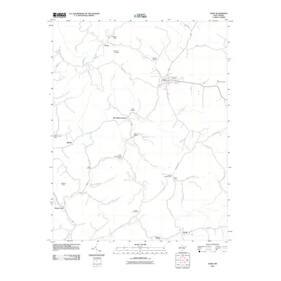
2011 Map of Union
USGS Topo · Published 2011About this map
Union serves as a central hub in this corner of Monroe County, situated where Knobs Rd and Willow Bend Rd meet. The landscape is defined by the winding paths of Indian Creek and Turkey Creek, which are spanned by the Laurel Creek Covered Bridge and the Indian Creek Covered Bridge. These structures, along with the Willow Bend Post Office, reflect the enduring rural infrastructure of the region.
Find a feature on this map
54 named features on this map. Tap any name to fly to it.
Don’t see what you’re looking for? This feature index may not catch every label — zoom into the map to look around manually.
Map Details
Editions of this 2011 Union Map
This is the sole edition of this map. No revisions or reprints were ever made.
Other maps of this area

1887 · Hinton
USGS Topo · 1:125,000

1887 · Lewisburg
USGS Topo · 1:125,000

1890 · Dublin
USGS Topo · 1:125,000

1890 · Christiansburg
USGS Topo · 1:125,000

1891 · Lewisburg
USGS Topo · 1:125,000

1891 · Dublin
USGS Topo · 1:125,000

1892 · Hinton
USGS Topo · 1:125,000

1921 · Alderson
USGS Topo · 1:48,000

1921 · Ronceverte
USGS Topo · 1:48,000

1923 · Ronceverte
USGS Topo · 1:62,500