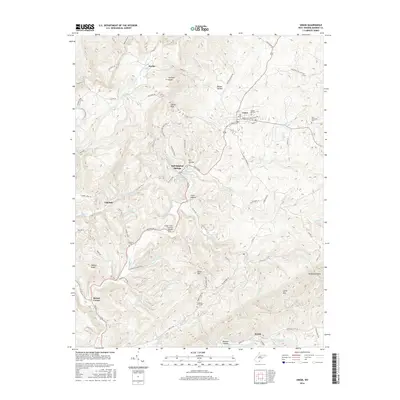
2016 Map of Union
USGS Topo · Published 2016About this map
Salt Sulphur Springs stands as a focal point in this portion of Monroe County, where mineral hydrology including Sweet Sulphur Spring, Iodine Spring, and Salt Sulphur Spring converge. The landscape is defined by the winding course of Indian Creek, crossed by the Indian Creek Covered Bridge south of the main settlement at Union. This area reflects a deep-rooted history through its numerous burial grounds, such as the Old Rehobeth Cem and Green Hill Cem. The terrain rises sharply from the creek valleys toward elevations like Swoopes Knobs and Pynes Mountain, with smaller communities like Lillydale, Zenith, and Raines Corner established along the valleys and gaps. The drainage network is dense, featuring named waterways like Turkey Creek and Humphreys Run that have shaped the placement of local farmsteads and transport routes.
Find a feature on this map
87 named features on this map. Tap any name to fly to it.
Don’t see what you’re looking for? This feature index may not catch every label — zoom into the map to look around manually.
Map Details
Editions of this 2016 Union Map
This is the sole edition of this map. No revisions or reprints were ever made.
Other maps of this area

1887 · Hinton
USGS Topo · 1:125,000

1887 · Lewisburg
USGS Topo · 1:125,000

1890 · Dublin
USGS Topo · 1:125,000

1890 · Christiansburg
USGS Topo · 1:125,000

1891 · Lewisburg
USGS Topo · 1:125,000

1891 · Dublin
USGS Topo · 1:125,000

1892 · Hinton
USGS Topo · 1:125,000

1921 · Alderson
USGS Topo · 1:48,000

1921 · Ronceverte
USGS Topo · 1:48,000

1923 · Ronceverte
USGS Topo · 1:62,500