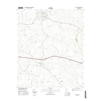
2017 Map of Union Point
USGS Topo · Published 2017About this map
Union Point serves as a significant crossroads in northeastern Greene County, where the landscape is defined by the headwaters of the Ogeechee River system. The town's historical development is closely tied to the Railroad Pond and the network of rail lines that once anchored the local economy. Moving south toward the smaller settlements of Siloam and White Plains, the map reveals a high density of family and community burial grounds, including the Saw Dust Cem and Hugh Moore King Cem. The terrain is drained by the N Fork Ogeechee River and S Fork Ogeechee River, which snake through the region alongside numerous smaller bodies of water like Credille Lake and George Lake. This layout demonstrates how rural land use and community centers remained oriented around traditional watercourses and transit corridors into the early 21st century.
Find a feature on this map
106 named features on this map. Tap any name to fly to it.
Don’t see what you’re looking for? This feature index may not catch every label — zoom into the map to look around manually.
Map Details
Editions of this 2017 Union Point Map
This is the sole edition of this map. No revisions or reprints were ever made.
Other maps of this area

1906 · Crawfordville
USGS Topo · 1:125,000

1953 · Athens
USGS Topo · 1:250,000

1958 · Athens
USGS Topo · 1:250,000

1959 · Athens
USGS Topo · 1:250,000

1963 · Athens
USGS Topo · 1:250,000

1965 · Woodville
USGS Topo · 1:24,000

1965 · Union Point
USGS Topo · 1:24,000

1966 · Philomath
USGS Topo · 1:24,000

1966 · Crawfordville
USGS Topo · 1:24,000

1972 · Penfield
USGS Topo · 1:24,000