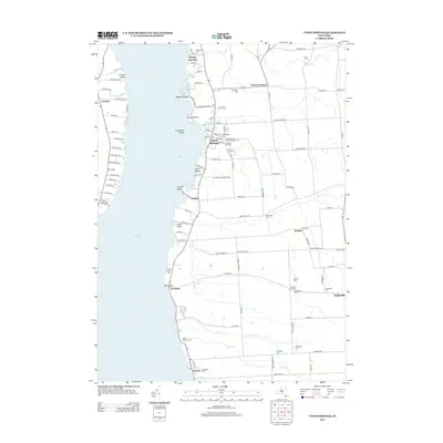
2013 Map of Union Springs
USGS Topo · Published 2013About this map
Cayuga Lake defines the western half of this landscape, its shoreline dotted with points and islands such as Frontenac Island and Canoga Island. The village of Union Springs serves as a focal point for the eastern shore, characterized by its dense street grid including Basin St, Chapel St, and Homer St. Further inland, the terrain is shaped by agricultural patterns and small crossroads settlements like Cooneys Corners and Powers Corner.
Find a feature on this map
105 named features on this map. Tap any name to fly to it.
Don’t see what you’re looking for? This feature index may not catch every label — zoom into the map to look around manually.
Map Details
Editions of this 2013 Union Springs Map
This is the sole edition of this map. No revisions or reprints were ever made.
Other maps of this area

1899 · Auburn
USGS Topo · 1:62,500

1902 · Geneva
USGS Topo · 1:62,500

1902 · Genoa
USGS Topo · 1:62,500

1902 · Ovid
USGS Topo · 1:62,500

1902 · Auburn
USGS Topo · 1:62,500

1942 · Ovid
USGS Topo · 1:31,680

1942 · Sheldrake
USGS Topo · 1:24,000

1942 · Genoa
USGS Topo · 1:24,000
1943 · Genoa
USGS Topo · 1:31,680

1943 · Cayuga
USGS Topo · 1:31,680