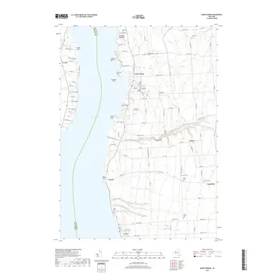
2019 Map of Union Springs
USGS Topo · Published 2019About this map
Cayuga Lake dominates this landscape, its eastern shoreline defined by the historic lakefront villages of Union Springs, Levanna, and Aurora. The map illustrates a deeply rooted agricultural and religious landscape, evidenced by numerous burial grounds including multiple instances of the Old Quaker Cem and the Chestnut Hill Cem. The terrain is marked by significant hydrological features such as the deep incision of Great Gully and the various points extending into the water, including Allens Point and Farleys Point.
Find a feature on this map
93 named features on this map. Tap any name to fly to it.
Don’t see what you’re looking for? This feature index may not catch every label — zoom into the map to look around manually.
Map Details
Editions of this 2019 Union Springs Map
This is the sole edition of this map. No revisions or reprints were ever made.
Other maps of this area

1899 · Auburn
USGS Topo · 1:62,500

1902 · Geneva
USGS Topo · 1:62,500

1902 · Genoa
USGS Topo · 1:62,500

1902 · Ovid
USGS Topo · 1:62,500

1902 · Auburn
USGS Topo · 1:62,500

1942 · Ovid
USGS Topo · 1:31,680

1942 · Sheldrake
USGS Topo · 1:24,000

1942 · Genoa
USGS Topo · 1:24,000
1943 · Genoa
USGS Topo · 1:31,680

1943 · Cayuga
USGS Topo · 1:31,680