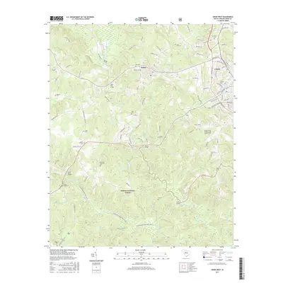
2017 Map of Union West
USGS Topo · Published 2017About this map
Sumter National Forest blankets the southern portion of this region, where the Tyger River winds past landmarks like Cedar Bluff Bridge and the Tyger River Canoe Trail. The landscape transitions from the dense timberlands of the forest to the industrial and residential outskirts of Union and the mill town of Buffalo. Genealogists will find a high concentration of burial sites throughout the rural terrain, ranging from the Buffalo Cem near the town center to the Old Lower Fairforest Cem and the Padgetts Creek Cem further south. The map documents a complex network of creeks, including Fairforest Creek and Shoal Cr, which defined early property lines and settlement patterns. Infrastructure such as the Union County Airport at Troy Shelton Field and river crossings like Murphy Bridge illustrate the modern connectivity of this South Carolina Piedmont area.
Find a feature on this map
100 named features on this map. Tap any name to fly to it.
Don’t see what you’re looking for? This feature index may not catch every label — zoom into the map to look around manually.
Map Details
Editions of this 2017 Union West Map
This is the sole edition of this map. No revisions or reprints were ever made.
Other maps of this area

1941 · Spartanburg
USGS Topo · 1:250,000

1947 · Spartanburg
USGS Topo · 1:62,500

1949 · Spartanburg
USGS Topo · 1:62,500

1953 · Spartanburg
USGS Topo · 1:250,000

1960 · Spartanburg
USGS Topo · 1:250,000

1963 · Spartanburg
USGS Topo · 1:250,000

1964 · Spartanburg
USGS Topo · 1:250,000

1969 · Cross Anchor
USGS Topo · 1:24,000

1969 · Union West
USGS Topo · 1:24,000

1969 · Sedalia
USGS Topo · 1:24,000