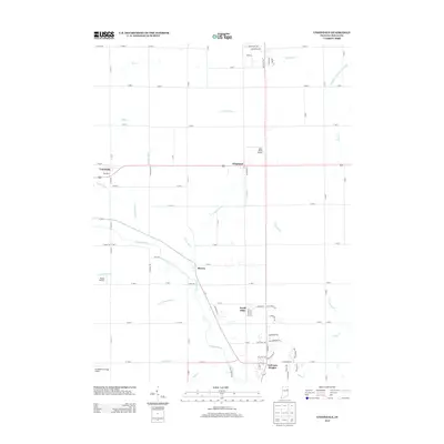
2013 Map of Uniondale
USGS Topo · Published 2013About this map
The Wabash River meanders diagonally across this northern Wells County landscape, anchoring a series of small settlements and rural crossroads in the early 21st century. The village of Uniondale and the hamlet of Kingsland sit along the northern rail and road corridors, while Murray occupies a bend in the river further south. The land between these communities is defined by an intricate network of managed waterways, including Griffin Ditch, Dowty Ditch, and Eightmile Cr, illustrating the intensive drainage required for agricultural stability in this region. Private aviation is surprisingly prominent in this rural setting, with small landing strips like Skip's Place Airport and Grandlienard-Hogg Airport punctuating the grid of county roads. Residential development is concentrated in areas like North Oaks and Toll Gate Heights, reflecting the modern suburban footprint expanding near the traditional town centers.
Find a feature on this map
87 named features on this map. Tap any name to fly to it.
Don’t see what you’re looking for? This feature index may not catch every label — zoom into the map to look around manually.
Map Details
Editions of this 2013 Uniondale Map
This is the sole edition of this map. No revisions or reprints were ever made.
Other maps of this area

1953 · Muncie
USGS Topo · 1:250,000

1955 · Markle
USGS Topo · 1:24,000

1956 · Muncie
USGS Topo · 1:250,000
1961 · Zanesville
USGS Topo · 1:24,000

1962 · Poe
USGS Topo · 1:24,000

1962 · Uniondale
USGS Topo · 1:24,000

1962 · Ossian
USGS Topo · 1:24,000

1962 · Liberty Center
USGS Topo · 1:24,000

1962 · Preble
USGS Topo · 1:24,000

1962 · Linn Grove
USGS Topo · 1:24,000