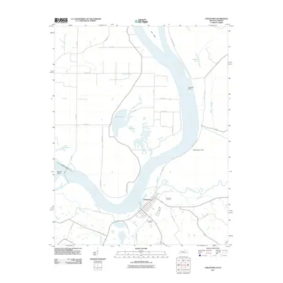
2011 Map of Uniontown
USGS Topo · Published 2011About this map
Uniontown sits at a prominent bend in the Ohio River, serving as a focal point for this river-bottom landscape in the early twenty-first century. The map documents the intricate hydrology of the region, where the river's path is marked by features like Slim Island, Towhead Island, and the wide curve of Mississippi Bend. Inland, the terrain is defined by a network of wetlands and drainage patterns, including Hovey Lake, Dry Lake, and the meandering Rattle Slough. Local road names like Union Ferry Rd and Hamilton Mine Rd hint at the historical transportation and extractive industries that shaped Union County. For those tracing local heritage, the map clearly identifies both Uniontown Cemetery and Saint Agnes Cemetery, along with several family-named roads and rural crossings that have persisted through generations of agricultural change.
Find a feature on this map
39 named features on this map. Tap any name to fly to it.
Don’t see what you’re looking for? This feature index may not catch every label — zoom into the map to look around manually.
Map Details
Editions of this 2011 Uniontown Map
This is the sole edition of this map. No revisions or reprints were ever made.
Other maps of this area

1905 · New Haven
USGS Topo · 1:62,500

1906 · New Haven
USGS Topo · 1:62,500

1907 · Morganfield
USGS Topo · 1:62,500

1916 · Shawneetown
USGS Topo · 1:62,500

1917 · Uniontown
USGS Topo · 1:62,500

1949 · Paducah
USGS Topo · 1:250,000

1949 · New Haven
USGS Topo · 1:62,500

1949 · Morganfield
USGS Topo · 1:24,000

1950 · Paducah
USGS Topo · 1:250,000

1951 · Waverly
USGS Topo · 1:24,000