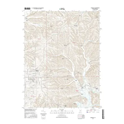
2016 Map of Unionville
USGS Topo · Published 2016About this map
Unionville and the eastern outskirts of Bloomington occupy a landscape defined by deep ridges and narrow creek valleys. The terrain transitions from the developed residential blocks of Hoosier Acres and Eastern Heights in the west to the deeply dissected hills of the east. These ridges, including Bender Ridge and Lampkin Ridge, are separated by numerous named hollows such as Penitentiary Hollow and Sulphur Spring Hollow, reflecting a rugged topography that has historically shaped the road network.
Find a feature on this map
175 named features on this map. Tap any name to fly to it.
Don’t see what you’re looking for? This feature index may not catch every label — zoom into the map to look around manually.
Map Details
Editions of this 2016 Unionville Map
This is the sole edition of this map. No revisions or reprints were ever made.
Other maps of this area

1908 · Bloomington
USGS Topo · 1:48,000

1910 · Bloomington
USGS Topo · 1:62,500

1942 · Franklin
USGS Topo · 1:125,000

1946 · Belmont
USGS Topo · 1:24,000

1947 · Allens Creek
USGS Topo · 1:24,000

1947 · Unionville
USGS Topo · 1:24,000

1947 · Elkinsville
USGS Topo · 1:24,000

1948 · Hindustan
USGS Topo · 1:24,000

1948 · Morgantown
USGS Topo · 1:24,000

1950 · Belmont
USGS Topo · 1:24,000