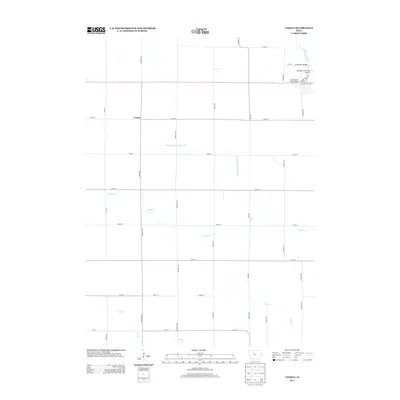
2013 Map of Unique
USGS Topo · Published 2013About this map
Unique sits as the central point of this agricultural landscape in Humboldt County, where a rigid grid of gravel roads defines the layout of the prairie. The northeast corner of the quadrangle is marked by the winding path of the Des Moines River, which creates the area’s only significant breaks in the rectilinear geometry. Here, infrastructure like the Berkheimer Bridge and Des Moines River Bridge connects the rural townships to more developed zones, while the Humboldt Municipal Airport serves as a modern landmark. Much of the land’s character is shaped by water management, evidenced by the presence of Drainage Ditch Number 20 and several natural streams including Indian Cr, Deer Cr, and Bass Cr. This 2013 survey provides a clear view of the modern rural infrastructure and small settlements that comprise this corner of the Iowa plains.
Find a feature on this map
37 named features on this map. Tap any name to fly to it.
Don’t see what you’re looking for? This feature index may not catch every label — zoom into the map to look around manually.
Map Details
Editions of this 2013 Unique Map
This is the sole edition of this map. No revisions or reprints were ever made.
Other maps of this area

1923 · Fort Dodge
USGS Topo · 1:62,500

1954 · Fort Dodge
USGS Topo · 1:250,000

1957 · Fort Dodge
USGS Topo · 1:250,000

1958 · Fort Dodge
USGS Topo · 1:250,000

1972 · Livermore
USGS Topo · 1:24,000
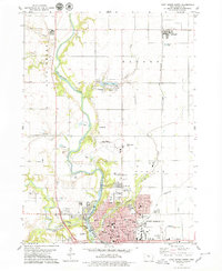
1979 · Fort Dodge North
USGS Topo · 1:24,000

1979 · Humboldt
USGS Topo · 1:24,000

1979 · Clare
USGS Topo · 1:24,000

1979 · Gilmore City SW
USGS Topo · 1:24,000

1979 · Unique
USGS Topo · 1:24,000