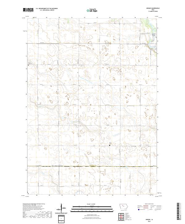
2022 Map of Unique
USGS Topo · Published 2022About this map
Des Moines River winds through the northeast corner of this Humboldt County terrain, anchoring a landscape defined by its agricultural grid and water management systems. The map illustrates a highly organized rural infrastructure, featuring the extensive Drainage Ditch Number 20 and tributaries like Indian Cr and Deer Cr. This 2022 survey captures the intersection of the Humboldt and Webster County line, documenting the precise placement of local landmarks such as the Humboldt Municipal Airport. For genealogists and local historians, the sheet preserves the locations of established burial grounds including Mount Hope Cem and Our Saviors Cem, alongside a network of family-named roads like Sheldon Ave and Jackson Ave that connect these agrarian communities.
Find a feature on this map
42 named features on this map. Tap any name to fly to it.
Don’t see what you’re looking for? This feature index may not catch every label — zoom into the map to look around manually.
Map Details
Editions of this 2022 Unique Map
This is the sole edition of this map. No revisions or reprints were ever made.
Other maps of this area

1923 · Fort Dodge
USGS Topo · 1:62,500

1954 · Fort Dodge
USGS Topo · 1:250,000

1957 · Fort Dodge
USGS Topo · 1:250,000

1958 · Fort Dodge
USGS Topo · 1:250,000

1972 · Livermore
USGS Topo · 1:24,000
1979 · Fort Dodge North
USGS Topo · 1:24,000

1979 · Humboldt
USGS Topo · 1:24,000

1979 · Clare
USGS Topo · 1:24,000

1979 · Gilmore City SW
USGS Topo · 1:24,000

1979 · Unique
USGS Topo · 1:24,000