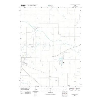
2010 Map of University Park
USGS Topo · Published 2010About this map
University Park and the eastern fringes of Oskaloosa dominate the western portion of this Mahaska County landscape, where education and local industry meet the rural Iowa plains. This 2010 survey records the intricate network of local roads such as Pilgrim Path and Patriot Ave that connect residential areas to the University Park Post Office. To the east, recreation and small-community life center around Lake Keomah and the adjacent Keomah Village, held by the Keomah Dam. The terrain is defined by the winding course of the South Skunk River and its tributaries, including Spring Creek and Middle Creek. This map is particularly valuable for genealogists, as it documents numerous burial sites scattered across the township, from the University Park Cemetery to more remote locations like Wymore Cemetery and Bloomfield Cemetery. Aviation and transit are also represented by the Edgren Airport and the smaller Roth Landing Field south of the city.
Find a feature on this map
56 named features on this map. Tap any name to fly to it.
Don’t see what you’re looking for? This feature index may not catch every label — zoom into the map to look around manually.
Map Details
Editions of this 2010 University Park Map
This is the sole edition of this map. No revisions or reprints were ever made.
Other maps of this area

1954 · Des Moines
USGS Topo · 1:250,000

1956 · Des Moines
USGS Topo · 1:250,000

1956 · Ottumwa North
USGS Topo · 1:62,500

1957 · Des Moines
USGS Topo · 1:250,000

1965 · Gibson
USGS Topo · 1:24,000

1965 · Rose Hill
USGS Topo · 1:24,000

1968 · University Park
USGS Topo · 1:24,000

1968 · Oskaloosa
USGS Topo · 1:24,000

1968 · Kirkville
USGS Topo · 1:24,000

1968 · Eddyville
USGS Topo · 1:24,000