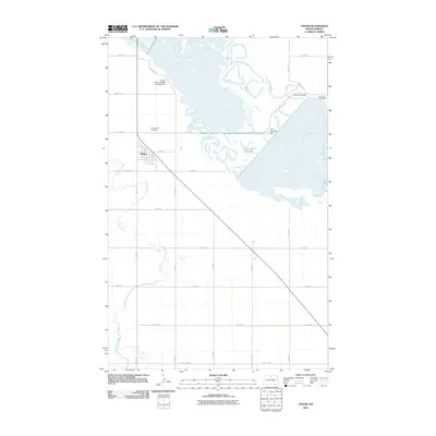
2011 Map of Upham
USGS Topo · Published 2011About this map
Upham serves as the primary settlement on this McHenry County landscape, situated where the grid of rural section roads meets the winding path of Cut Bank Creek. The hydrology of the region is significantly defined by the broad, braided waters of the Souris River as it flows toward the Unit 320 Reservoir. Managed water levels are evident at Dam Number 320, which regulates the river’s course through this northern prairie environment. Local history and genealogy researchers will find the locations of Bloomfield Cemetery and Melankton Cemetery clearly marked, alongside specialized infrastructure such as the J Clark Salyer Refuge Landing Field. The map records a transition point where the river is crossed by the Freeman Bridge, highlighting the vital road connections like Main St and County Hwy-17 that link this agricultural community to the surrounding plains.
Find a feature on this map
24 named features on this map. Tap any name to fly to it.
Don’t see what you’re looking for? This feature index may not catch every label — zoom into the map to look around manually.
Map Details
Editions of this 2011 Upham Map
This is the sole edition of this map. No revisions or reprints were ever made.
Other maps of this area

1949 · Granville NE
USGS Topo · 1:24,000

1949 · Kramer
USGS Topo · 1:24,000

1949 · Bantry
USGS Topo · 1:24,000

1950 · Kramer
USGS Topo · 1:24,000

1950 · Upham SE
USGS Topo · 1:24,000

1950 · Deep
USGS Topo · 1:24,000

1950 · Upham
USGS Topo · 1:24,000

1950 · Newburg SE
USGS Topo · 1:24,000

1950 · Bantry NW
USGS Topo · 1:24,000

1950 · Bantry
USGS Topo · 1:24,000