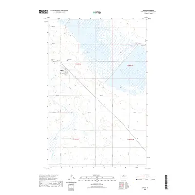
2020 Map of Upham
USGS Topo · Published 2020About this map
Upham serves as the central hub of this North Dakota landscape, situated along a grid of section lines and local roads like 80th St N. The town's local streets, including O'Niell St and Fouts St, anchor a community defined by its proximity to the wide, marshy corridor of the Souris River. This waterway and the nearby Unit 320 Reservoir dominate the northeastern quadrant, illustrating the managed water systems critical to this region of McHenry County. To the west and south, the meandering path of Cut Bank Creek cuts through the plains, while several local cemeteries, including Bloomfield Lutheran Cem and Peace Reformed Cem, provide essential landmarks for genealogists and local historians tracking the area’s settlement history. These sites, along with Melankton Cem, are often located near section corners, preserving the legacy of the families who established the surrounding agricultural tracts.
Find a feature on this map
33 named features on this map. Tap any name to fly to it.
Don’t see what you’re looking for? This feature index may not catch every label — zoom into the map to look around manually.
Map Details
Editions of this 2020 Upham Map
This is the sole edition of this map. No revisions or reprints were ever made.
Other maps of this area

1949 · Granville NE
USGS Topo · 1:24,000

1949 · Kramer
USGS Topo · 1:24,000

1949 · Bantry
USGS Topo · 1:24,000

1950 · Kramer
USGS Topo · 1:24,000

1950 · Upham SE
USGS Topo · 1:24,000

1950 · Deep
USGS Topo · 1:24,000

1950 · Upham
USGS Topo · 1:24,000

1950 · Newburg SE
USGS Topo · 1:24,000

1950 · Bantry NW
USGS Topo · 1:24,000

1950 · Bantry
USGS Topo · 1:24,000