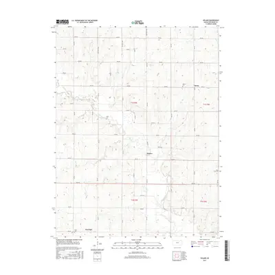
2015 Map of Upland
USGS Topo · Published 2015About this map
Upland and its surrounding agricultural terrain in Dickinson County are defined by a strict grid of section-line roads and the winding path of Chapman Cr. This 2015 survey reveals the persistence of early Kansas settlement patterns, where small communities like Sutphen and Moonlight serve as anchor points for the rural landscape. Genealogists will find several burial grounds mapped across these townships, including Liberty Cem near Upland and Jones Cem situated along the creek. The topography transitions from the flat upland plains to the more varied drainage basins of Curtis Cr in the northeast. The road system, labeled with a systematic coordinate style such as 3400 Ave and Paint Rd, reflects the modern organization of the county's historical farm-to-market network.
Find a feature on this map
40 named features on this map. Tap any name to fly to it.
Don’t see what you’re looking for? This feature index may not catch every label — zoom into the map to look around manually.
Map Details
Editions of this 2015 Upland Map
This is the sole edition of this map. No revisions or reprints were ever made.
Other maps of this area

1886 · Junction City
USGS Topo · 1:125,000

1889 · Junction City
USGS Topo · 1:125,000

1889 · Abilene
USGS Topo · 1:125,000

1889 · Parkerville
USGS Topo · 1:125,000

1891 · Clay Center
USGS Topo · 1:125,000

1894 · Junction City
USGS Topo · 1:125,000

1894 · Abilene
USGS Topo · 1:125,000

1894 · Parkerville
USGS Topo · 1:125,000

1947 · Fort Riley
USGS Topo · 1:62,500

1950 · Alida
USGS Topo · 1:24,000